(Closed access)
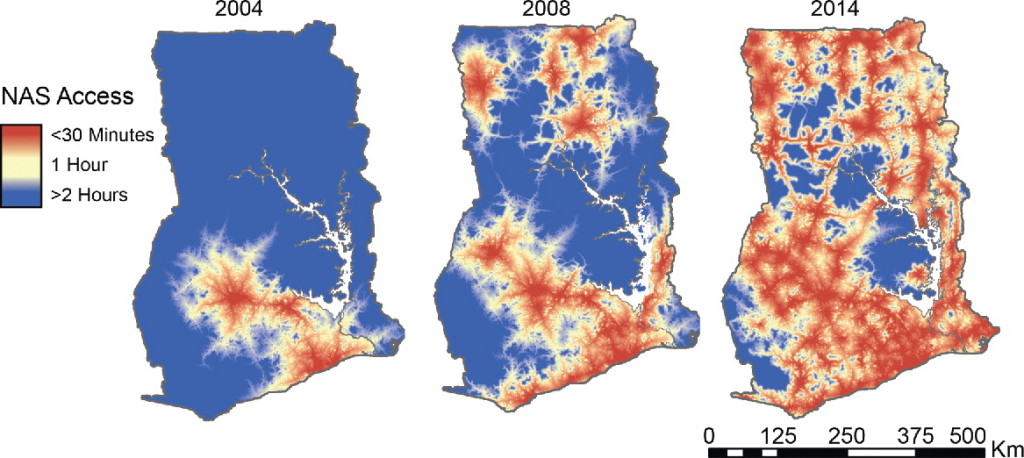
Ghana’s National Ambulance Service is one of a handful of formal EMS systems in sub-Saharan Africa, and provides an excellent model for the development of EMS systems in the region. A number of interesting research papers have been published in regards to the NAS, most recently this beautiful and clever analysis, produced despite a dearth of typical data sources. ArcGIS was used to evaluate the addition of vehicles to the 128 ambulance stations in Ghana, and the effect of the expansion of NAS services on modelled response times since 2004 was described. I would be very interested in seeing this model fit to empirical data, but if nothing else network analysis certainly produces lovely maps.

